
[responsivevoice_button voice=”Hindi Female”]
It is not news that Google has been recording the world via cameras for over a decade, but recently it gave an insight into how big a project it is. Google has stated that they have captured over 10 million miles of images for Street View, and by some math, it equals to circling the earth 400 times.
Google Earth lets people browse through more than 36 million square miles of high definition satellite images, and those images cover an area where about 98 percent of the population lives. Apple has also started its little venture to capture the earth but it is miles behind in compared to Google, literally.
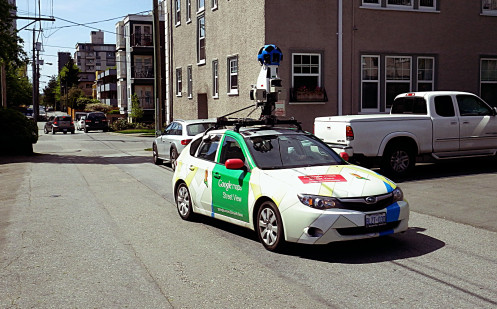
Google uses Street View cars equipped with multiple cameras and lidars to capture images from various angles, and places where cars can’t reach, it uses Street View trekker which is a backpack to be mounted on to animals or scout troops.
Google also explained that it uses photogrammetry, a technique to stitch multiple images together. Street View has allowed the tech-giant to assign addresses to millions of buildings previously unknown, and normal people can browse all this without even going to their place of dreams.


